COMMON AREAS
COMMON AREAS ARE OUTLINED IN PURPLE
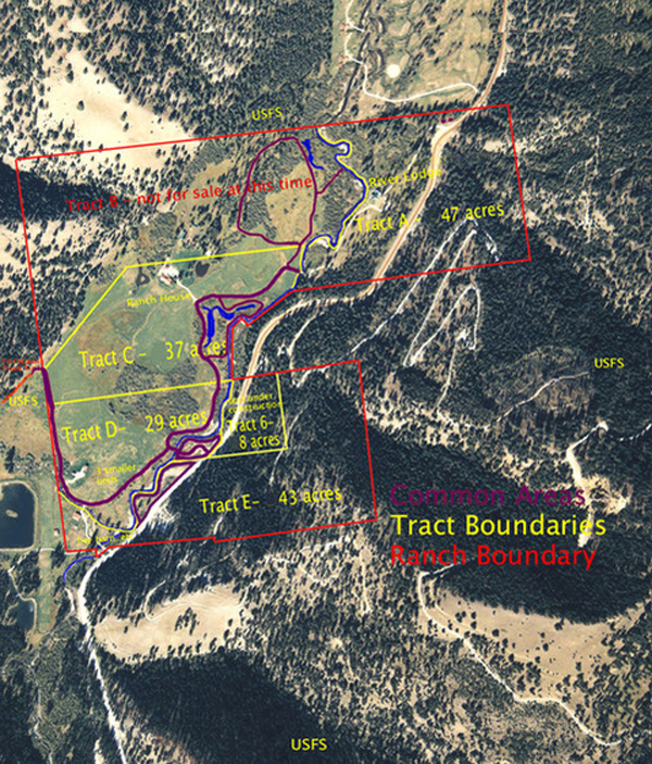
It should be noted that the term "common area" does not reflect ownership of these areas by the Alta Meadow Ranch Home Owners Association, but rather easements granted by each owner for common use. Areas for our mutual benefit have been established to reflect the interdependent nature of the different parcels on the ranch. Each one contributes to the pool of common areas based on its location and topography. It is with this type of arrangement that each tract's value is enhanced, as is the convenience and enjoyment afforded everyone. Roads designated for common use are mostly for pedestrian and equestrian traffic. Vehicle easements are in place for Tracts B, C, & E to use Alta Meadow Trail to reach West Fork Road via the main entryway bridge on Tract D.
On Tract A the northernmost portion of Alta Meadow Trail (as it exits from West Fork Road) has been designated by the Postal Service and Bitterroot Sanitation as sites for delivery of mail and collection of refuse, respectively. The structures have been built in a manner compatible with ranch architecture and unobtrusively located. A sturdy collection structure well away from the residences is also a safety feature because of the occasional bear in search of an easy meal. The bridge between Tracts A and C as well as that portion of Alta Meadow Trail on Tract A may NOT be used for vehicular traffic unless the main entryway bridge on Tract D is unusable.
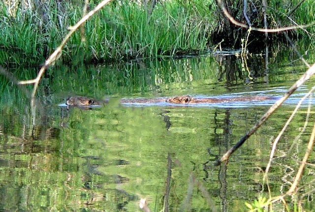
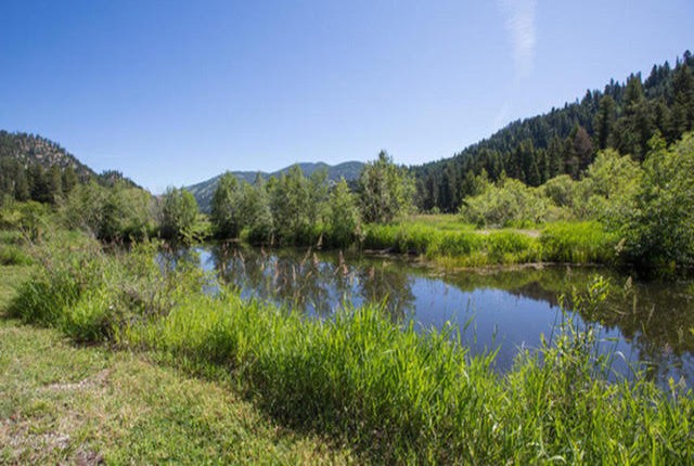
Tract B contributes a hiking trail through the meadow to a natural pond, at times the home of beavers and muskrats. Along the way is a spur to a river access point. The trail progresses into a forest glade with an observation deck. From there it winds though a wooded area forming a loop back to Alta Meadow Trail (the road). This trail is for pedestrian use only.
Tract C contributes two ponds which are well away from the Ranch House and partially hidden by willows. They are stocked and the trout are fed by the association. That portion of Alta Meadow Trail leading to the ponds is also a common area for pedestrian and equestrian traffic. The access spur to the trail system on Tract B is limited to pedestrian use.
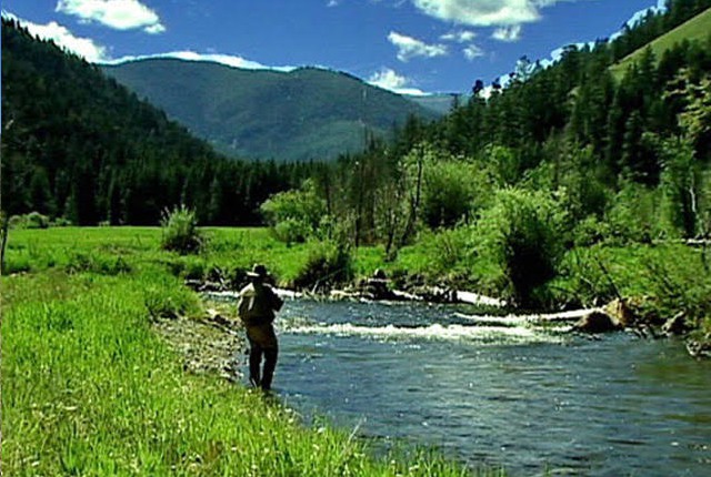
All of Alta Meadow Trail on Tract D is common area, providing pedestrian and equestrian access for Tracts A, E and 6 to Forest Service land, and vehicle access for Tracts B, C, and E. Also the eastern portion of Tract D between West Fork Road and the river is designated for common use, providing access to a flood plain on the eastern side of the river. It is an excellent fishing spot.
Tract 6 is relatively small with no obvious common areas, but with its excellent view of the meadow, the Chalet is uniquely situated to serve as our "neighborhood watch".
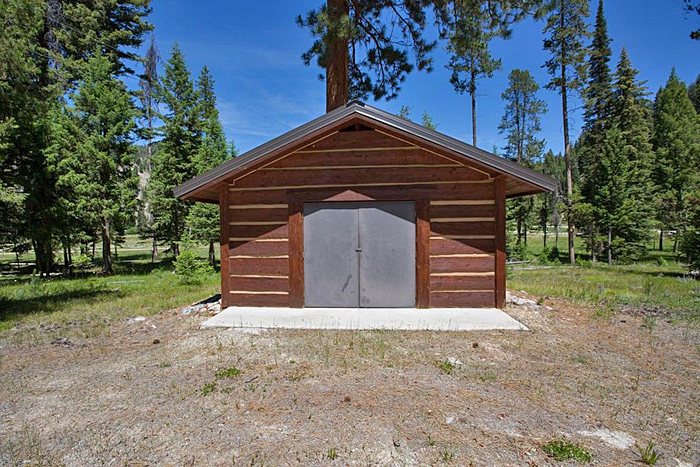
Tract E contributes a portion of the 3,000 sf implement shed for storage of hay and equipment used to maintain and repair common area infrastructure. A burn area has been designated on Tract E for slash accumulated on the ranch.
Disclosures
In 1997, accompanying major improvements on West Fork Road, the southern portion of the river running through Alta Meadow was re-engineered to enhance flood protection and fish habitat. It has been a resounding success on both counts. This was done with natural materials - rocks weirs, logs and tree roots. The same technique has been used by Alta Meadow Ranch,. in two locations between Tracts A and B, once to protect the River House from future problems, and on another occasion when there was bank erosion upstream requiring repair. Also, after the fires west of the ranch in 2000, debris washed down Chicken Creek and lodged against some streamside willows. This resulted in the deposition of silt, thereby shifting the course of the stream out of its normal path onto the meadow. This also required intervention, albeit much less extensive. There can be no assurance that events such as these will not recur and require repair in the future.
In August 2000 the Bitterroot Valley experienced its worst fire event in living memory. The Chicken Creek drainage had not burned since records were begun in 1870. Choked with fuel, it was the site of a massive conflagration, but despite this the ranch sustained no significant damage. The fire crews designated our meadow as a base of operations, stating "we can defend this valley". They started backfires in the northwestern portion of the ranch (Tract B) involving groves of smaller trees. Subsequently, most of that fuel has been removed, thereby making the ranch safer. Also, conventional wisdom says that much of the fuel west of the ranch has been consumed, making a similar event less likely in the future. However there does remain the possibility of wilderness fires and significant damage to ranch property.
Alta Meadow Ranch is surrounded by wilderness and is habitat for wild animals that are unpredictable and could be dangerous. The ranch is most assuredly not a "theme park" and owners and guests should exercise reasonable caution when moving about the meadow and forest areas. To date, no owner or staff member has been harmed by wild animals, but this does not imply that it could not happen in some unforeseen circumstance. Poisonous snakes have never been found in the Upper West Fork Valley.
As in any mountainous region at the confluence of three streams, Alta Meadow is subjected to occasional strong winds. This can result in downed trees, and if this occurs near a structure, significant damage to that building could occur. Also, it is possible that personal injury could result, although neither event has occurred to date.