
![]()
![]()
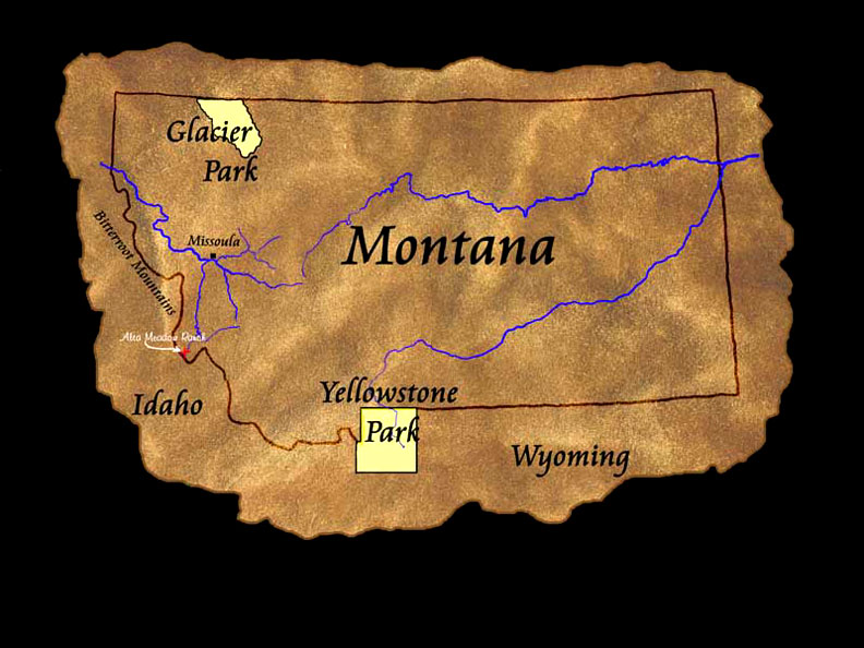
| ALTA
MEADOW RANCH is located 100 miles south of Missoula, Montana - the usual
air destination for this area. The drive takes about 2 hours, and if
arriving by air, please refer to our map directing you through
Missoula
to HWY 93 south into the Bitterroot Valley, which is depicted with vendors along the way.
Closer to home, Alta Meadow Ranch is situated eleven miles south of the dam at Painted Rocks Lake on State Route 473 (West Fork Road) - a right turn off US HWY 93 four miles south of Darby, Montana. Start looking for the West Fork Road as you pass Trapper Peak on the right. When approaching from the south on HWY 93 (from Salmon, Idaho or the Big Hole Valley), a left turn at the "Connor cut off" is the shorter route to the West Fork Road. A right turn at mile marker #31 is the north entrance to the ranch leading to the River Lodge. The main entrance is approximately 1/2 mile further south where you will see a large "moose logo" sign. Alta Meadow Ranch is a scenic day's drive from several exceptional ski areas (Big Mountain, Big Sky and Sun Valley,) as well as Glacier National Park and Yellowstone National Park. See maps of the ranch and region. |
Homepage | Cabins |
Activities | Contact Us
© 1998 ALTA MEADOW RANCH, ALL RIGHTS RESERVED.